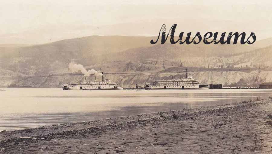
Relics and history of the Okanagan, visit our time capsules.
Traveling the world is a great joy in itself, to see the sites of large cities or small quaint towns. To make a visit to the Okanagan complete, to see how the people of the Okanagan lived decades, even centuries ago, is one of the best visits you can make. There is always something different, something odd, something unique, something special to find in local Okanagan large or small museums.
In the Okanagan, museums give a rich history of its pioneers who made Okanagan what it is today. These wonderful places display unique articles and things, historic or modern specific to a part of history we don’t normally see or know. Below are the regular museums in the Okanagan.
Specialty Museums
OKConnect provides a separate page to display Specialty Museum locations. To go straight to that page, click the link just below:
North Okanagan Museums
Armstrong Area museums

Map Image © Google Maps
Armstrong Area Museums
Armstrong was named after William Charles Heaton-Armstrong, a London banker, who provided financial backing for the Shuswap and Okanagan Railway in 1892. At that time, Armstrong was a lone box car serving as station and home for the rail agent of the Shuswap-Okanagan Railway.
The name “Spallumcheen” is an English word translation of the Thompson Indians name: “Spalemtsin” (pronounced: “sblajeen”), which means “riverbanks”, where the Splatisinac lived along the Shuswap River.
To learn more, visit the Armstrong-Spallumcheen Museum
Armstrong-Spallumcheen Museum and Art Gallery
Cherryville Area museums

Map Image © Google Maps
Cherryville Area Museums
Cherryville’s first pioneers settled on the banks of Cherry Creek (currently known as Monashee Creek) in the early 1860s, with only two houses and a third building under construction.
Between 1863 and 1895, the Cherry Creek area grew into a small mining camp with half the population consisting of Chinese miners.
Cherry Creek became Cherryville in 1919, when the local postmaster selected Cherryville as the name of the post office. Find out more at Cherryville Museum.
Cherryville Museum (CLOSED)
Enderby Area museums

Map Image © Google Maps
Enderby Area Museums
Enderby is located on the west bank of the Shuswap River (historically the Spallumcheen River). At Enderby, the Shuswap river changes its westerly flow to a northerly direction. This bend in the river was an ideal spot for steamboats coming from Kamloops to deliver supplies that would transship to settlers in the South Okanagan.
This commerce transportation hub became known as Lambly’s Landing or Steamboat Landing. It played a pivotal role in the early development of the Okanagan Valley. Visit Enderby Museums to find out more.
Enderby & District Museum & Archives
Lumby Area museums

Map Image © Google Maps
Lumby Area Museums
Lumby was originally known by a few names including Bull Meadows, Bessette, and White Valley. The “White Valley” name, some say, was named after George LeBlanc, a French Canadian miner who was mining for gold on Cherry Creek.
LeBlanc was one of the first …(more details next)
LeBlanc was one of the first pioneers to settle in the area. The surname LeBlanc is a French derivative from the French word “blanc”, which translates to “white”.
In 1861, Moses Lumby came to the White Valley area, and due to his positive involvement for White Valley, he became the area’s Government Agent in 1892. In 1894, when Moses Lumby passed away, Louis Morand and Quinn Faulkner officially changed the name of White Valley to Lumby in honour of Moses Lumby.
Visit Lumby to find out more of its history.
Lumby & District Museum
Vernon Area museums

Map Image © Google Maps
Vernon Area Museums
The area of Vernon was originally called Nintle-Moos-Chin (meaning “jumping over creek”), by the Syeelhwh Nation (Okanagan Indian Tribe), because the banks of BX Creek nearly met making it possible to leap across.
With pioneer settlements …(more details next)
With pioneer settlements to the area, early Vernon gained a total of four names, these were: Nintle-Moos-Chin, Forge Valley, Priest’s Valley and Centreville.
In 1864, Forbes and Charles Vernon settled in the area by purchasing a large ranch from fellow Irishman Charles Houghton. In 1887, Vernon gained its official status, named after Forbes George Vernon.
Visit Vernon Museum to learn more!
Greater Vernon Museum & Archives
Central Okanagan Museums
Kelowna Area museums

Map Image © Google Maps
Kelowna Area Museums
During 1859, French Roman Catholic Oblate missionaries, Father Pandosy, Father Richard and Brother Surel, were the first European settlers in the Kelowna area. They established their mission near l’Anse au Sable (Bay of Sand), a area named by Father Pandosy to describe the sandy shoreline of Okanagan Lake. This Roman Catholic mission was known as the “Okanagan Mission”, a name used to describe the area for miles around.
Between 1860-1862,…(more details next)
Between 1860-1862, as the story goes, a francophone pioneer, August Gillard, had taken possession of some land and built a Kekuli (also known as a pit-house or a quiggly hole, which is to mean “beneath” or “under”.) It was a style of a shelter design from the Okanagan First Nations people.
One day, as a group of Okanagan First Nations people were passing by, saw smoke coming from the shelter and stopped to see who lived there. As August Gillard emerged from his Kekuli, the natives called out “Kim-ach-touch”, meaning brown bear.
Around 1861, renowned pioneer Eli Lequime established his settlement near the Okanagan Mission. He built a ranch, operated the first blacksmith shop and hotel-saloon.
In 1892, Eli’s sons, Bernard and Leon Lequime (the Lequime Bros.), laid out a townsite along the Okanagan Lake after the Canadian Pacific Railway (CPR) established a steamer service on the Lake. The survey of the land for the township was conducted by John Coryell, CE for the Lequime Bros.
In the process of naming the new townsite, the old story of August Gillard came up and what the First Nations named August, “Kim-ach-touch” (brown bear). This consideration led from the Salish word for brown bear to the Salish word for male grizzly bear, and that transformed into the Anglicized name of “Kelowna”. Today, the coat of arms for Kelowna shows a grizzly bear standing beside the center shield. The City of Kelowna was incorporated May 4, 1905
Kelowna Museums Society
Lake Country Area museums

Map Image © Google Maps
Lake Country Area Museums
Originally, the area of Lake Country was home to the indigenous Okanagan peoples, Syilx/Okanagan Nation, for over 200 years. Lake Country (incorporated 1995) is comprised of 4 communities: Oyama (1906), Okanagan Centre (1930), Carr’s Landing (1951) and Winfield (1968). Two communities of note, established their names from non-Canadians.
The first was Oyama…(more details next)
The first was Oyama. A name taken from a Japanese military commander, Field Marshal Oyama Iwao, due to his military accomplishments in the Russo-Japanese War of 1904-1905, that won him world-wide notoriety. This attracted the attention of a local mother of the post master Dr. W. H. Irvine who promoted the naming to Oyama.
The second, is Carr’s Landing, a name taken from an American civil war immigrant named Andrew Carr, who settled in the Commonage area, then known as Sunnywold, which was also a steam boat landing. The area was later renamed to Carr’s Landing in Andrew Carr’s honour.
Visit Lake Country Museum to find out more!
Lake Country Museum & Archives
Peachland Area museums

Map Image © Google Maps
Peachland Area Museums
It might be said that Peachland was founded from a bite of a peach. 197, J.M.Robinson, a mineral prospector, came to the Peachland area for mining interests, since mining gold was the dominate mining interest in the Okanagan area during the late 1800’s.
His mining interests …(more details next)
His mining interests did not work-out, but one day he came across a settler’s cabin and was offered a fresh peach from a peach tree that grew near Trepanier Creek.
Robinson was so impressed with the delicious peach, his interests changed from mining to fruit tree farming. He and his company purchased prime farm land and started a peach fruit orchard. From that, Robinson named the area Peachland and the rest is “history”.
Visit Peachland museum to find out more!
Peachland Museum
West Kelowna Area museums

Map Image © Google Maps
West Kelowna Area Museums
As with most of the Okanagan area, the Westbank area was originally populated by the Okanagan (syilx) before any European settlers arrived. They were a self-sufficient and self-governing people. The Okanagan (syilx) communities hunted, fished, gathered and traded goods between them.
It was about 1811…(more details next)
It was about 1811 that Westbank became a trade centre before it was settled by any Europeans.
After 1811, the area was named MacDonald’s Plain, after an officer with the Hudson’s Bay Company. By 1848, when the Okanagan Brigade Trail was abandoned in favour of the International Boundary settlement, the name MacDonald’s Plain was forgotten.
In 1872, Susan Allison settled on the west bank of Okanagan Lake and was the first white woman to settle in the area. After 1872, Susan named the area Sunnyside, but that name became lost because the area did not become developed into a community, and Susan Allison moved out after the winter of 1880-1881 when the harsh winter caused her a large loss of cattle.
In 1901, the area was named: “Westside”, because it became known as the west side of Okanagan Lake and the name was used by a Leonard Hayman, who apparently had claim to all the land on the west side.
In 1901, the name was later changed to “Halls Landing” because of Robert Hall who built a small wharf landing on the west bank of Okanagan Lake for the docking of boats to deliver equipment and supplies for his grain venture.
On May 01, 1902, the area got its first post office and it was named “Westbank” by John Davidson and Shannon Marshall became the first Post Master. Westbank also adopted a colloquial name of “Westside”, obviously due to its historic references.
The name Westbank became official since previous names were not registered or made official, but were names used to identify the land and area of Westbank.
On October 6, 1936, Westbank officially became a town and in March 15, 1983, its status was changed to a community.
It was not until 2008, residents were asked in a community opinion poll to select a new name for the city. In that poll, the name “West Kelowna” narrowly won over the name of “Westbank”, and West Kelowna became official on January 30, 2009.
The name Westbank continues to survive, and West Kelowna is also known as Westbank.
Sncewips Museum
Westbank Museum
South Okanagan Museums
Hedley Area museums

Map Image © Google Maps
Hedley Area Museums
Hedley is located near the mouth of Hedley Creek in the Similkameen region of southern British Columbia. Hedley’s history started as a nickel plate mine called “Hedley Camp” (1900–1955). The owner of this nickle mine claim was Robert R. Hedley.
The Similkameen area …(more details next)
The Similkameen area was among the first areas of British Columbia where pioneers prospected for metals and gold, as well as farmed and ranched.
From this influx of pioneers and miners, some planned to establish “Similkameen City”, which was about 2.5 miles west of Hedley around 1901. These plans never worked out, likely because in the same area, the town site of Hedley was already established (1900) from its origins of Hedley Camp.
Visit Hedley Museum to find out more!
Hedley Museum
Keremeos Area museums

Map Image © Google Maps
Keremeos Area Museums
The name of Keremeos was derived from “Keremeyeus”, a Smilkamix language and Similkameen dialect of the Okanagan native people. Keremeyeus is to mean, “creek which cuts its way through the flats“. Keremeyeus refers to Keremeos Creek which flowed down from Upper Benchlands to the Similkameen River.
In 1813…(more details next)
In 1813, a fur trader named Alexander Ross, is believed to be the first white-man to come to the Keremeyeus area. Ross managed the Pacific Fur Company, an Okanagan Fort and trading post just over the Canada/US border. In 1873, an Englishman, Barrington Price, pre-empted land in the area. He founded a cattle ranch and in 1877 built a gristmill (known now as Old Gristmill and Gardens).
In 1887, the first European settlers arrived to farm oats and wheat and opened the first Post Office. By 1893, 16 homesteads were established and commerce grew in the Keremeyeus area. In 1906, the Keremeos Land Co was formed for the development of orchards. In 1907 the first train arrived.
During the 143 years of development, the name “Keremeyeus” was eventually transmuted to “Keremeos” and the town of Keremeos legally established its name in British Columbia, October 6, 1936 on a Geological Survey. On October 30, 1956, Keremeos became incorporated as a Village Municipality.
South Similkameen Museum (Keremeos)
Naramata Area museums

Map Image © Google Maps
Naramata Area Museums
Originally, Naramata was named “Nine Mile Point”, apparently because the top west portion of the land extended, like a point, into Okanagan Lake and was 9 miles from Penticton.
Around 1905,…(more details next)
Around 1905, John Moore Robinson and his brother, Englishmen from Brighton England, moved into the area. Fruit farming was a going trend in the Okanagan area and the Robinson brothers saw a great opportunity to develop this area into parcels of farm land for gentlemen farmers. They purchased large tracts of land and sub-divided them into fruit-farms.
During the fruit farm development venture, John Robinson named the area East Summerland, a carry-on name from land up north that was named Summerland (1906), but this eventually lead to confusion, so John Robinson renamed the area to “Brighton Beach”, in honor of his family’s roots in England.
By 1907, the name of Brighton Beach did not last long when (apparently), the spiritualist wife of the local postmaster, Mrs. Gillespie, held a séance, during which she claimed to be possessed by the spirit of a great Sioux Indian Chief named Big Moose. This spirit spoke of his love for his wife named “Nar-ra-mat-tah”. John Robinson was immediately taken by it. He dropped a few letters and the name Naramata was born. The name Brighton Beach was subsequently dropped and renamed to Naramata, which has stuck ever since.
Visit the Naramata Museum to find out more!
Naramata Heritage Museum
Oliver Area museums

Map Image © Google Maps
Oliver Area Museums
Inkameep Indians (Osoyoos Band and part of the Syilx People of the Okanagan Nation), lived in the Oliver area for hundreds of years before the Europeans came to the Okanagan.
In 1887…(more details next)
In 1887, the first stream of Europeans came to the area for gold mining. By 1890, the area gained its first town named “Town of Fairview”, established on the benches (benchland) north-west of area of Oliver. During the gold rush, Fairview was one of B.C.’s largest towns. Around 1919, Fairview became a ghost town soon after the gold tapped out.
In 1919, John Oliver (British Columbia’s 19th premier) started the Southern Okanagan Lands Project (SOLP), an initiative to irrigate 8000 acres of semi-arid desert land in the area. It was nicknamed, “The Ditch”. This project was successful, transforming the land into lush orchards and farms and providing employment to the area.
This led to the survey of the original townsite of Oliver in 1921, the beginnings of Oliver. The new township was established to serve the settlement of unemployed veterans from the First World War who worked for the SOLP project. The first post office was opened 1 May 1921. The township of Oliver was named after Premier John Oliver. The town of Oliver was officially adopted October 6, 1936 on Geological Survey sheet 420A. On December 31, 1945, Oliver was officially Incorporated as a Village Municipality.
Oliver & District Museum
Osoyoos Area museums

Map Image © Google Maps
Osoyoos Area Museums
The name Osoyoos is derived from a Syilx (Okanagan Native) word “Sooyoos” (suius), from the Salish meaning, “narrows of the lake”. This is a formation of land that narrows Osoyoos Lake, almost splitting it into two. This is easily seen when looking at a map of Osoyoos Lake. Sooyoos became Osoyoos when, according to the story, a Minister by the name of O’Reilly put the letter “O” in front of “Sooyoos” to harmonize with other nearby town names.
In 1811, …(more details next)
In 1811, European settlers and fur traders arrived in the area. They travelled up the Okanagan River to Osoyoos Lake and farther north. In 1859 a Canadian from Colville, Adam Beam, found gold in Rock Creek just east of Osoyoos. In 1861, a custom house was built in the Osoyoos area for John Carmichael Haynes who was the tax collector.
By 1907 the first commercial orchard was established, growing cherries, apricots, peaches, plums, and apples. In 1919, then Premier John Oliver, started an irrigation project for the South Okanagan area named “South Okanagan Lands Project (SOLP)”, which got the nickname of “The Ditch”. It provided needed irrigation to the Osoyoos area.
As development progressed, a town grew in the Osoyoos area. The town of Osoyoos was adopted October 6, 1936 on BC Geological Survey sheet 420A (82 E). It was incorporated as a Village Municipality January 14, 1946; and confirmed October 7, 1954.
Osoyoos & District Museum and Archives
Penticton Area museums

Map Image © Google Maps
Penticton Area Museums
Apparently, there were numerous native language names from various tribes in the Okanagan area for the English version of Penticton. One of which was the Okanagan dialect of the Salish tribe, the word Pen-tak-tin, to mean: “a place of permanent abode where waters pass by“.
The English settlement …(more details next)
The English settlement of Penticton started with Thomas Ellis, an Irish immigrant was the first European to settle in Penticton area in 1865. He became one of Okanagan’s most successful cattle ranchers. Thomas Ellis eventually owned property from Naramata to the American border.
Between 1877-78, G.M. Dawson wrote in his Geological Survey Progress Report about Thomas Ellis, “Mr. Ellis has a fine farm known as Penticton…”
On December 1, 1889, the Penticton Post Office was opened and Thomas Ellis was made its postmaster.
In 1892 Thomas Ellis retired and sold a large portion of his property to developers who laid out a small townsite at the foot of Okanagan Lake that became Penticton.
By 1908, the small townsite of Penticton grew to a population of 600. By January, 1, 1909, Penticton became incorporated as a District Municipality.
Penticton Museum & Archives
Princeton Area museums

Map Image © Google Maps
Princeton Area Museums
Princeton lies just east of the Cascade Mountains and where the Tulameen and Similkameen Rivers converge. The Princeton area was favoured by the Similkameen people as the source of red ochre, because the Tulameen river is one of the largest and most significant sources of ochre.
The Similkameen people…(more details next)
The Similkameen people considered ochre as a source of spiritual power and a means to communicate with the spirits.
In 1860, John Fall Allison, the first European settler to the area, arrived at Vermilion Forks, which was the original early town of Princeton. Allison made several mining claims on coal, copper and gold, and established the first cattle ranch in the area.
Vermilion Forks was also known as “Red Earth Forks” because of large deposits of red ochre. The word “Forks” was given because of the junction of the Tulameen and Similkameen Rivers. The town was also known as “Similkameen” and “Allison’s”, the latter because of John Allison.
These names were replaced with “Princeton” in 1860 by Governor James Douglas (Governor of the Colony of British Columbia, 1858-1864). The name of Princeton was to honour of the Prince of Wales (Edward II). It was not uncommon to see the name “Princeton” written as “Princetown”.
Princeton & District Museum
Summerland Area museums

Map Image © Google Maps
Summerland Area Museums
The Okanagan Syilx lived in the Summerland / Okanagan area for many years prior to any white settlement and this area was grazing land for them. Around 1811, European fur traders passed through the area and the Syilx took part in this trade.
In the late 1880’s,…(more details next)
In the late 1880’s, when the fur trade diminished, cattle ranchers and orchardists moved into the area, establishing settlements near the west side of Okanagan Lake. From these settlements, a town formed named Trout Creek, which was the former name of Summerland.
George Barclay, an Englishman, migrated to the Trout Creek area in 1885 to start cattle ranching. Through his efforts and purchases of land, Barclay built his first cattle ranch.
George Barclay wanted to develop a teaching ranch for “Gentleman Ranchers” from England. He sought English men who had an interest in learning about cattle raising, horses, and riding the open range.
He achieved his dream by the 1890’s, where Barclay operated the largest cattle ranch in the Trout Creek area. Eventually, Barclay met Caroline Mary Cornwall from Ashcroft, BC. They married in 1897, and by 1901, had two children. They ran a farm and his ranch in Trout Creek.
During 1902, George Barclay sold his ranch and moved to Ashcroft Manor because his wife wanted to return to her home town of Ashcroft. The person who bought Barclay’s ranch was Sir Thomas Shaughnessy. He was the president of the Canadian Pacific Railway (1899 to 1918). Shaughnessy purchased Barclay’s land and ranch through his company, Summerland Syndicate.
With Shaughnessy’s efforts and managerial skills of John Moore Robinson, they created the new Summerland Development Company. In 1902, Trout Creek was renamed to Summerland when Robinson promoted a land subdivision on the lake shore that same year.
On November 1, 1902, Summerland’s first Post Office was opened and Frederick S. Moule became its postmaster.
On December 21, 1908, Summerland was incorporated as “The Corporation of the District of Summerland”.
A historical note stated that Robinson previously founded Peachland and later founded Naramata.
Summerland Museum & Archives